The short answer: for most ancient kingdoms that grew dramatically in population, wealth, and political power, the enabling industry was agricultural surplus, managed and taxed by a state bureaucracy. Trade, mining, and military conquest all played supporting roles, but none of them scale a kingdom the way a reliable, measurable, and taxable food supply does. That said, "these kingdoms" is doing a lot of work in your question, so let's pin down exactly which civilizations we're talking about before going deeper.
Which Industry Allowed These Kingdoms to Grow as They Did

Samuel Rourke
11 Apr 2026
Which kingdoms are we actually talking about?

The phrase "these kingdoms" usually shows up in history and geography classrooms when discussing river-valley civilizations of the ancient world: Egypt (Old, Middle, and New Kingdom periods, roughly 3100–1070 BCE, plus the later Ptolemaic period 332–30 BCE), Mesopotamian states like Sumer, Akkad, Babylon, and Assyria (roughly 3500–539 BCE), the Indus Valley polities (2600–1900 BCE), and early Chinese states along the Yellow River (Shang and Zhou dynasties, roughly 1600–256 BCE).
The question also sometimes refers to medieval African kingdoms like Mali, Ghana, and Songhai (roughly 300–1600 CE), or Mesoamerican states like the Maya and Aztec. Each of these civilizations had its own primary growth engine, but the pattern is strikingly consistent across all of them. An open educational chapter by the Rebus Community explains that [irrigation techniques in the Sumer region](https://press. rebus.
community/historyoftech/chapter/technologyofmesopotamia_irrigation/) helped drive the formation of the city-state and wider urban development.
If you're unsure exactly which kingdoms your course or research is focused on, the fastest way to narrow it down is to look at the geographic region and time period in your source material, then match it to the crop and river system associated with that region. That framing connects directly to what environmental factors helped civilizations grow, because the environment almost always points directly to the enabling crop and therefore the enabling industry.
The industry that actually powered the growth
Across nearly every major ancient kingdom, the primary growth engine was organized agricultural surplus production, collected and redistributed through a state taxation system. This is different from just "farming." The key word is organized. A village growing barley to feed itself is subsistence farming. A kingdom growing barley, recording the harvest, taxing a fixed percentage, storing the surplus in state granaries, and using that stored grain to pay soldiers, scribes, and builders, that's an industry in the truest sense.
Long-distance trade, mining (gold, copper, obsidian), and imperial administration each added wealth and complexity, but none of them could exist at scale without a food surplus underneath them. Trade networks needed merchants and guards who had to eat. Mines needed laborers who needed to be fed. Armies needed grain. The surplus agriculture system was the foundation everything else sat on.
Trade, mining, and administration: real contributors, but secondary

For kingdoms like Mali and Songhai in West Africa, gold and salt trade were genuinely enormous wealth generators. For the Phoenicians and later Carthage, maritime trade dominated. For the Aztec, tribute systems extracted goods from conquered peoples. These exceptions matter and are worth studying closely. But even in trade-dominant kingdoms, the baseline population growth (which is what "grow as they did" really means) traces back to food security. A kingdom without reliable calories cannot sustain the population density needed to staff markets, armies, or mines.
How organized agricultural surplus actually worked, step by step
Using ancient Egypt as the clearest example (because the documentary record is unusually complete), here is how the system functioned from field to state treasury:
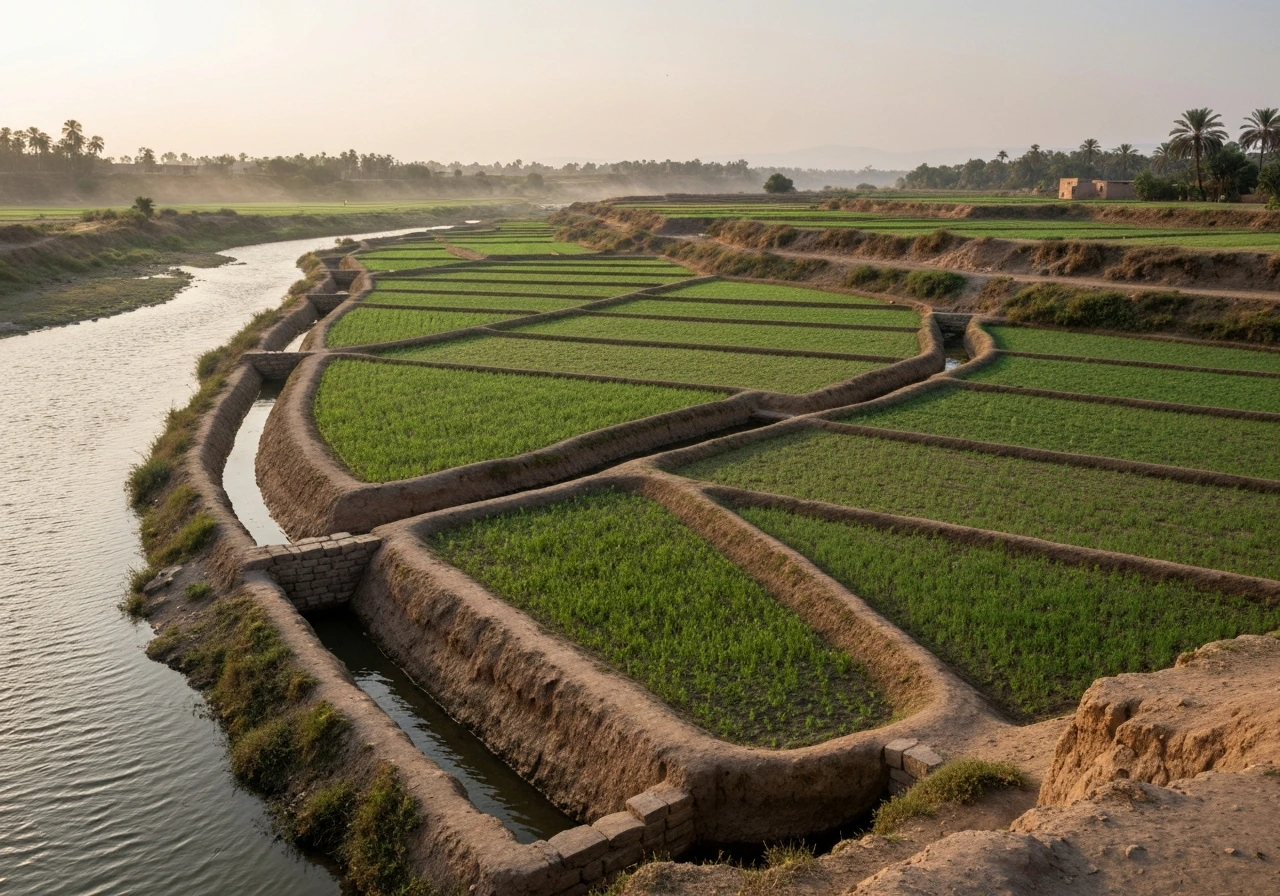
- Flood and soil preparation: The Nile's annual inundation deposited rich silt across the floodplain, naturally fertilizing fields. Farmers prepared planting beds as waters receded, typically in October or November.
- Crop selection and planting: Emmer wheat and barley were the primary staple crops, with flax grown for linen. These crops were well-matched to the hot, dry climate and the short growing window between flood recession and summer heat.
- Harvest and threshing: Grain was cut, bundled, and brought to threshing floors where animals trampled it to separate grain from chaff. This step was critical because it created a concentrated, measurable product that could be taxed.
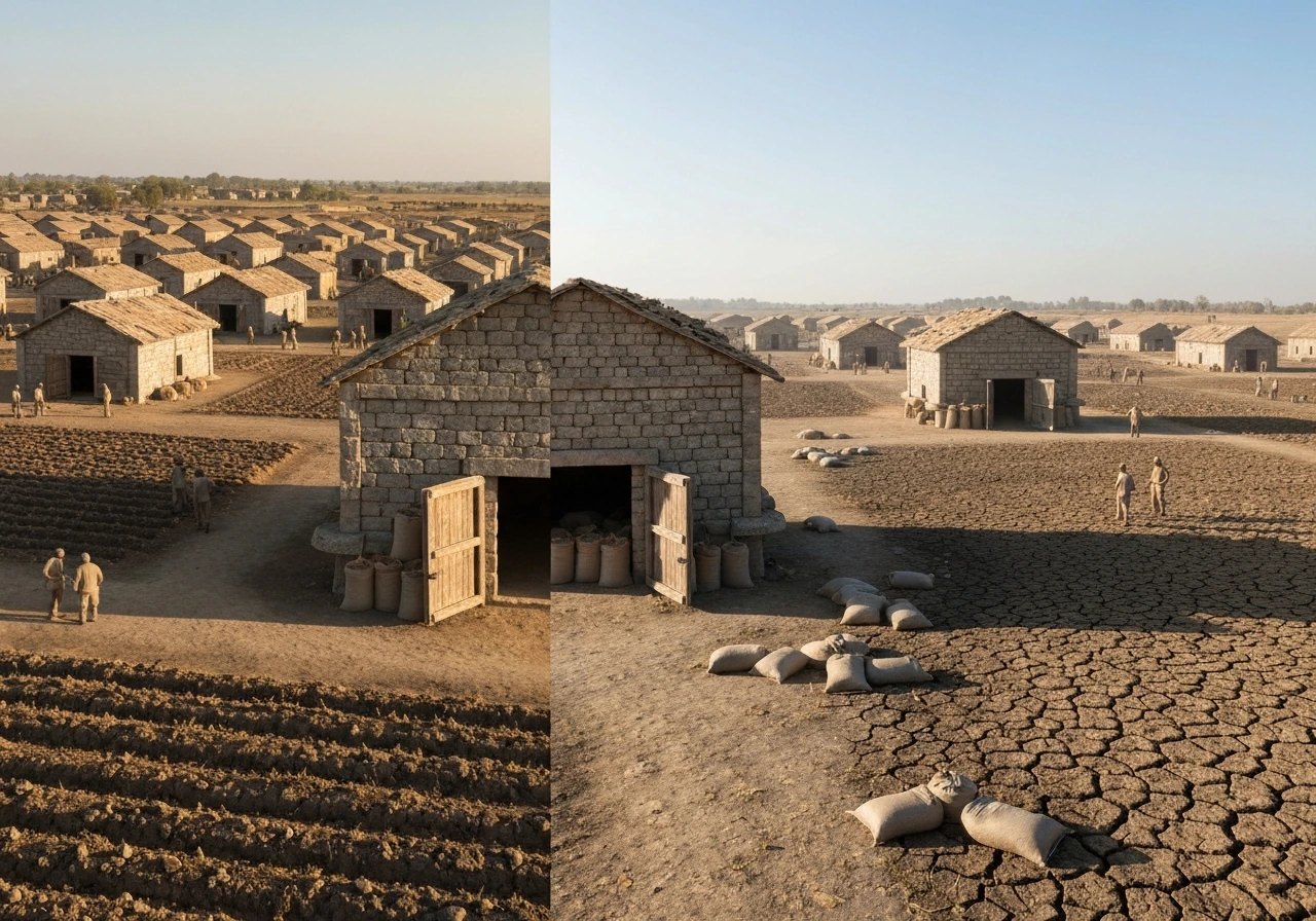
- Measurement and recording: State scribes measured grain volumes at the threshing floor. In the Ptolemaic period, a provincial official called a sitologos tracked grain stocks in village and district granaries and determined how much would be transferred upward to the central administration, including an annual transfer of a portion of the harvest tax to Alexandria.
- Storage and redistribution: Grain went into local granaries first, then into district granaries, then into major state facilities. In Roman Egypt, a highly bureaucratic supply and transport system ensured harvested tax grain was stored and then transported by land or canal to river ports for trans-shipment to Alexandria.
- Tax calibration: The state used tools like the Nilometer, a measuring device that tracked annual flood levels, to set tax rates. The quality and height of the flood directly predicted crop yield, and that prediction determined the tax levy. This is one of the oldest known examples of data-driven fiscal policy.
- Redistribution into state functions: Stored grain paid soldiers, funded temple construction, compensated scribes and officials, and fed urban workers who built pyramids and canals. The grain essentially functioned as currency.
The infrastructure supporting this system included irrigation canals (to extend the flood zone and smooth out year-to-year variability), granary networks, roads and canal routes for transport, ports (especially Alexandria as the central hub), and a trained bureaucratic class to record and manage the whole operation. After harvest and threshing, grain was received by sitologoi and then moved onward to larger granaries in the metropoleis before being sent to harbours for trans-shipment to Alexandria. The Abusir Papyri, an administrative archive from the Old Kingdom found in storage rooms at a royal mortuary complex, show that this bureaucratic grain management system was already sophisticated thousands of years before the Ptolemaic period.
Why this industry specifically allowed kingdoms to grow to scale
Four factors directly connect agricultural surplus management to kingdom-scale growth:
- Population growth: Reliable food supply reduces famine risk, lowers infant mortality, and supports higher population density. More people means more labor, more tax revenue, and larger armies.
- Tax revenue and state finance: When the state can reliably predict, measure, and collect a grain tax, it can plan multi-year projects: canals, monuments, military campaigns, trade expeditions. This is what separates a chiefdom from a kingdom.
- Non-farming specialization: A 20–30% agricultural surplus frees a significant portion of the population to become soldiers, craftspeople, scribes, priests, and merchants. Specialization accelerates technological and administrative development.
- Political legitimacy: In most ancient kingdoms, the ruler's ability to manage food distribution (especially in drought years) was the core of their political authority. Control the grain, control the kingdom.
To understand why people concentrated in these agricultural zones in the first place, it helps to read about why settlements grew near the river valleys. The logic is straightforward: river valleys combined water access, flat arable land, natural fertilization from floods, and transport routes. That geographic package made intensive agriculture possible, and intensive agriculture made kingdoms possible.
Geography and climate: the crops that made it all viable
No agricultural surplus system works without the right combination of soil, water, temperature range, and growing season. The kingdoms that grew most dramatically were almost always located in regions where a small number of high-yield staple crops could be grown intensively with relatively predictable water sources.
| Kingdom/Region | Primary Staple Crops | Water Source | Climate Type | Key Geographic Advantage |
|---|---|---|---|---|
| Ancient Egypt (Nile Valley) | Emmer wheat, barley, flax | Nile annual flood | Hot desert with riparian floodplain | Predictable flood cycle, rich silt deposit, minimal rainfall needed |
| Mesopotamia (Tigris-Euphrates) | Barley, emmer wheat, dates | Irrigation canals from rivers | Semi-arid, hot summers | Flat alluvial plain, extensive canal irrigation possible |
| Indus Valley (Harappan) | Wheat, barley, cotton, sesame | Indus River seasonal floods | Semi-arid, monsoon-influenced | River-fed plains, early cotton cultivation for trade |
| Early China (Yellow River) | Millet, rice (later), soybeans | Yellow River floods and rainfall | Temperate continental | Loess soil highly fertile, millet drought-tolerant |
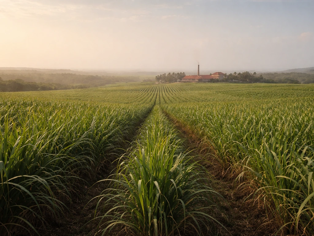
| Mali/Songhai (West Africa) | Sorghum, millet, rice (Niger inland delta) | Niger River flood zone | Semi-arid Sahel and savanna | Niger inland delta as breadbasket, gold trade as multiplier |
The crops that enabled kingdoms were almost always ones with high caloric yield per acre, long storage life (grains store far better than vegetables or fruit), and adaptability to the local water cycle. Barley, in particular, was a kingdom-builder across the ancient world because it tolerates salinity and drought better than wheat, making it viable in marginal soils. Why ancient civilizations grew near rivers is fundamentally a story about where these crops could be grown reliably and at scale.
The Nile case is especially instructive. As explained in detail when looking at how the Nile floods helped farmers grow crops, the annual inundation was not just a water source but a natural fertilization event, depositing fresh mineral-rich silt every year without requiring the farmer to do anything. This meant Egyptian soils did not exhaust the way Mesopotamian soils did under heavy irrigation (which caused long-term salinization), giving Egypt unusual agricultural longevity as a productive state.
How to verify which industry really drove a kingdom's growth
If you're writing a paper, answering an exam question, or just trying to make sure you have the right answer, here are the concrete evidence types to look for:
- Administrative records: The presence of grain accounting documents (like the Abusir Papyri from Old Kingdom Egypt or clay tablet inventories from Mesopotamian temples) directly proves that surplus agriculture was being systematically managed by the state. No records means no organized industry at scale.
- Granary archaeology: Large, centralized granary structures found near palaces, temples, or ports indicate state-level grain management. The size and distribution of granaries tells you how much surplus was being moved and stored.
- Tax and tribute documents: Look for evidence of grain-based taxation. In Egypt, the Nilometer's administrative role in setting tax rates is a direct link between agricultural output and state revenue.
- Population and settlement density: High population density in a geographically limited area (like the Nile Valley) strongly implies a food surplus supporting non-farming populations. Cross-reference settlement size with agricultural hinterland.
- Infrastructure investment: Canals, roads, and port facilities built at state expense indicate that the state had surplus resources to invest. The Roman Egypt canal-and-granary transport network is a clear example.
- Trade goods as secondary evidence: If trade goods (metals, luxury goods, spices) appear in the archaeological record but are not locally produced, the kingdom was wealthy enough to import them, which traces back to its primary income source.
For medieval kingdoms like the Iroquois Confederacy in North America, the same framework applies but with different crops. Looking closely at what the Iroquois grew reveals how the Three Sisters agricultural system (corn, beans, and squash grown together) created a reliable, nutrient-balanced surplus that supported dense, politically organized settlements in the Northeast Woodlands, a different climate and region but the same fundamental dynamic.
What modern crops and regions reflect the same advantage today
The agricultural geography that powered ancient kingdoms has a direct parallel in the modern world. The same combination of flat land, reliable water, and high-yield staple crops that built Egypt or Mesopotamia now shows up in the world's major grain belts.
- The U.S. Midwest corn and soybean belt mirrors the Mesopotamian alluvial plain: flat, fertile, with managed water (now through drainage tile and irrigation rather than canals) and enormous surplus output that feeds populations far beyond the region.
- The Sacramento and San Joaquin Valleys in California replicate the Egyptian model more closely: a dry climate, irrigation-dependent agriculture, and extremely high per-acre yields of wheat, rice, and specialty crops feeding a massive urban population.
- The Ganges Plain in India, growing wheat and rice, is the modern equivalent of the Indus Valley agricultural system, still feeding one of the world's densest populations from the same geographic footprint.
- The Nile Delta still grows wheat, rice, and cotton using water management infrastructure that, while modernized, follows the same logic as the ancient flood-canal system.
- The Niger inland delta in Mali still produces rice and sorghum surpluses in the same zone that fed the Mali Empire, demonstrating just how durable these geographic advantages are across centuries.
The modern version of "which industry allowed these kingdoms to grow" plays out in the geography of port cities and inland transport hubs too. Just as Alexandria served as the collection and redistribution point for Egyptian grain, modern inland port cities serve as nodes where agricultural surplus moves from production zones to global markets. The question of where inland port cities grew in the Midwest connects directly to this ancient pattern: cities like St. Louis, Cincinnati, and Chicago grew where river transport met agricultural surplus, exactly the same logic that built Memphis on the Nile or Babylon on the Euphrates.
If you want to apply this thinking to your own region or research, start by identifying the staple crop or crops that made intensive agriculture possible in the area you're studying. Then look for evidence of state-level management: storage, taxation, transport, and redistribution. That combination, more than any other single factor, is what allowed ancient kingdoms to grow as they did, and it is still what determines which agricultural regions drive economic and population growth today.
FAQ
If the “industry” was agriculture, what exactly counts as industry rather than ordinary farming?
Look for evidence of state-level surplus handling, not just cultivation. That includes standardized taxation records, centralized granaries or warehouses, official scribes to count harvests, and redistribution channels that pay workers, soldiers, and administrators. Without those managerial steps, agriculture can feed people but it usually cannot reliably scale population and power.
Why didn’t trade or conquest alone produce the same kind of long-term growth?
Trade and conquest can add wealth quickly, but they do not reliably guarantee daily calories for large populations year after year. Armies, mines, construction labor, and bureaucracies still require stable food supplies, so kingdoms that relied primarily on raiding or commerce faced higher risk when supply routes, security, or foreign access broke down.
Are there cases where non-agricultural industries were the main driver of growth?
Sometimes resource extraction and commerce created exceptional wealth, like gold and salt in parts of West Africa or maritime trade for Phoenicians and Carthage. Still, those systems typically required a baseline agricultural base to feed workers and fund administration. In other words, they often amplify growth, but they usually do not replace surplus food as the underlying constraint.
How can I tell whether a kingdom used irrigation versus rain-fed farming, and why does it matter?
Check for irrigation infrastructure such as canals, reservoir systems, field boundaries designed for controlled watering, and records of water management. Irrigation can expand arable land and stabilize yields, but it also requires continued labor and governance. Rain-fed systems may be simpler, but growth becomes more sensitive to drought years, so the state often compensates with stronger storage capacity.
What role did grain storage play beyond “having more food”?
Storage turns seasonal harvests into year-round security, which reduces famine risk and supports larger standing forces. Evidence to look for includes granary networks, bulk transport routes to warehouses, and administrative texts that track quantities over time. Without durable storage, even high yields cannot consistently support population growth.
How did states reduce the risk of crop failure or bad harvests?
They typically relied on surplus buffers (large reserves), diversified staples when possible, and administrative systems that coordinate distribution during shortages. Evidence often appears as emergency distributions, ration records, or policies limiting grain price spikes. Some regions also used geographic strategies, like exploiting different microclimates or flood cycles.
Do high-yield staple crops always explain the biggest kingdoms, or can politics override the biology?
Biology sets constraints, politics determines outcomes within those constraints. If a region cannot support intensive staple production, political organization rarely sustains the population density needed for complex administration. However, strong institutions can still outperform neighbors by improving labor organization, tax collection efficiency, and storage and transport reliability.
In “the environment made it possible,” what environmental details should I focus on?
Focus on water predictability (flood cycles, river flow regularity, groundwater access), arable land extent, soil quality, and growing season length. For example, repeated flood fertilization can improve soil longevity, while heavy irrigation can create long-term salinization risks. Those factors influence whether surplus production is sustainable over centuries.
If I’m studying a specific region, what is the fastest research method to answer this question?
Start by identifying likely staple crops and their storage characteristics, then map where intensive cultivation was feasible. Next, search for signs of state extraction and management: tax ledgers, granary evidence, road or canal transport dedicated to hauling grain, and administrative officials responsible for accounting and redistribution. If those elements are missing, the “industry” may not have operated at kingdom scale.
How do I avoid a common mistake when interpreting “growth” in ancient kingdoms?
Don’t assume growth only means population. It can also mean increased urban concentration, expanded bureaucracy, military capacity, and longer-distance trade. Many kingdoms show major political or economic expansion even when population changes are modest, but sustained demographic growth almost always needs food security that can be stored and taxed.
Why do river-valley comparisons sometimes fail in class discussions?
Some civilizations had enabling crops outside classic river corridors, or they used different production systems like upland agriculture, floodplain grazing, or mixed staple rotations. Also, political boundaries shift, so a kingdom’s core might farm in one zone while its capital sits elsewhere. The right test is whether organized surplus extraction exists, not whether the map looks like a textbook river valley.
Next Articles
What Did Jamestown Grow and How They Farmed It
Learn what Jamestown colonists grew and the methods they used to plant, harvest, and adapt crops to Virginia conditions.
What Did the New England Colonies Grow? Major Crops
Major New England colonial crops explained by climate and soil, from corn and wheat to beans and hay, plus today’s paral
What Europeans Mostly Grew in Caribbean Colonies
Learn which crops Europeans dominated in Caribbean colonies, especially sugarcane, plus key supporting estate plants by