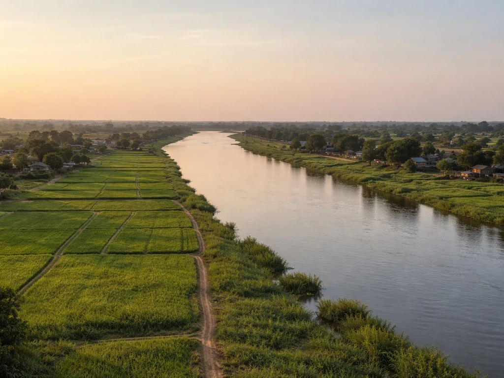
Settlements grew near river valleys because rivers solved almost every basic problem of early survival at once: they provided drinking water, deposited the most fertile soils on earth right at their banks, offered a built-in highway for moving goods, and supported fisheries, timber, and grazing on top of all that. No single resource drove this pattern. It was the whole bundle arriving in one place, and that bundle was so compelling that it repeated itself on every inhabited continent, from the Nile to the Indus to the Mississippi, across thousands of years.
Why Did Settlements Grow Near River Valleys? Causes

Samuel Rourke
12 Jun 2026
The core reasons settlements kept forming along rivers
Water is the obvious starting point. Before wells, pipes, or rainwater harvesting systems reached any real scale, a reliable river was the only guaranteed source of freshwater for drinking, cooking, and watering animals. But water alone does not explain the density and permanence of river-valley settlements. The real magnet was how water, soil, and movement combined into a package that was almost impossible to replicate anywhere else. That long-running pattern is the same reason many scholars ask why did ancient civilizations grow near rivers in the first place why ancient civilizations.
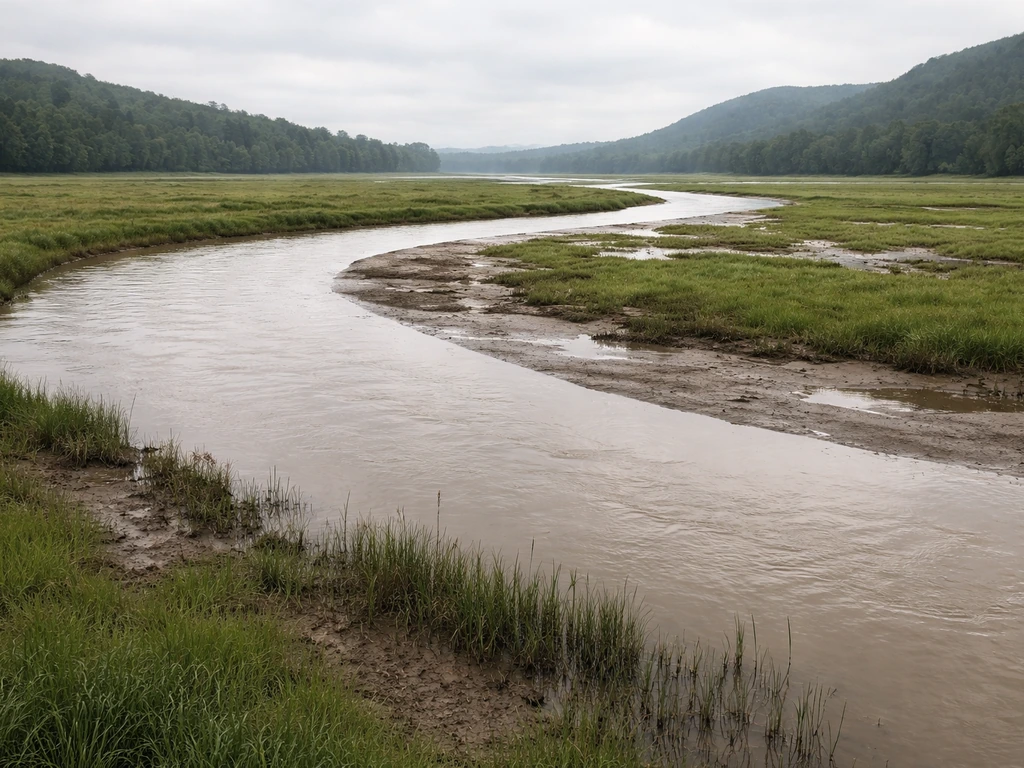
Floodplains are built by the river itself. When a river overtops its banks during high water, it slows down and drops the sediment it has been carrying, laying down thin sheets of nutrient-rich alluvial material season after season. Over centuries, that process builds a deep, layered, highly productive soil that farmers did not have to create or maintain artificially. They just had to show up and plant. Then the river doubled as a transport corridor, letting those farmers move surplus crops to markets without roads. Water, soil, and movement in one package: that is why the pattern repeated so consistently.
Soil and crop advantages: what floodplains actually give you
Floodplain soils are genuinely exceptional, and it helps to understand why rather than just take that on faith. When floodwaters spread across a valley floor, fine sediment particles and organic debris settle out. The finer the particle, the more nutrients it carries, which is why flood-deposited soils tend to be rich in phosphorus, nitrogen-supporting organic matter, and the micronutrients that plants need. Studies on river-floodplain systems confirm that floodplains act as nutrient traps: sedimentation processes literally retain phosphorus and other nutrients in the soil profile, with proximity to the river channel and flood frequency being the strongest predictors of how much deposits. The Nile is the textbook case. Its annual inundation left a layer of dark, nutrient-rich silt called the "black land" (kemet in ancient Egyptian), and ancient Egyptians tracked the flood level obsessively with measuring structures called nilometers precisely because they knew flood magnitude predicted harvest size. The Nile floods replenished fields with fresh nutrients and silt, which helped farmers sustain healthy crop growth year after year. Before the Aswan High Dam was built, the Nile was moving roughly 100 million tons of sediment downstream each year, most of it ending up on fields and in the delta.
The crops that thrived in these environments reflect the soil and water conditions. In the Indus Valley, wheat and barley were the principal staples, suited to the well-drained alluvial soils of the floodplain. For the Iroquois, the choice of crops likewise reflected what could reliably grow in their regional environments wheat and barley. The Harappan civilization also practiced multi-season cropping, growing winter and summer crops that needed different watering regimes, which is only practical when you have reliable water access nearby. Cotton domestication is associated with the Harappan period as well, with cotton products moving through long-distance exchange networks. In Mesopotamia, the Tigris and Euphrates supported barley especially well in early periods, though those soils came with a significant caveat about salinity that we will get to shortly. In Egypt, emmer wheat, flax, and later a wide range of vegetables and fruits grew on the flood-irrigated basin fields. The floodplain did not just support farming: it determined which crops were even possible in a given region.
Water management, flood risk, and the downsides people had to deal with
River valleys were not risk-free. Floods that built fertile soils could also destroy crops if the timing or magnitude was wrong, and droughts that lowered river levels meant irrigation failed entirely. Managing that uncertainty was one of the defining challenges of every river-valley civilization, and you can see it in the infrastructure they left behind.
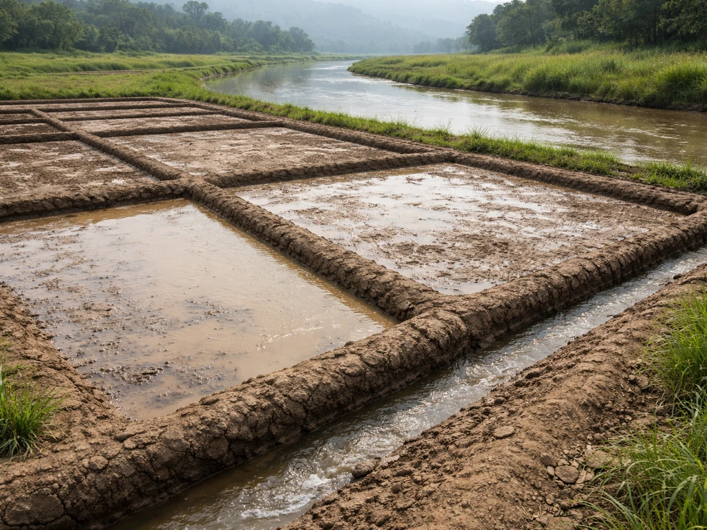
Egypt handled it through basin irrigation: fields were divided into earthen-banked basins that captured floodwater and held it while sediment settled, then drained when planting season arrived. Nilometers at multiple points along the river let administrators forecast harvest yields and even set tax rates based on flood level. Levees were constructed along the Nile over 3,000 years ago to channel and control where floodwaters went. The Harappan cities at the Indus took a different approach, investing heavily in drainage infrastructure: Mohenjo-daro had over 700 wells plus elaborate bathing and drainage systems, reflecting both the abundance of groundwater near the river and the need to manage it actively. Archaeological evidence of Indus or Harappan water management includes planned drainage systems and other public works that supported sanitation and may have helped sustain water availability for settlements blank" rel="noopener noreferrer">investing heavily in drainage infrastructure.
Mesopotamia illustrates what happens when water management falls short. The Tigris and Euphrates were more variable and harder to control than the Nile, requiring extensive canal networks to divert water to fields. Farmers cut ditches from canals to bring silt-laden water directly onto cropland, which worked well in the short term. But irrigation raises the local water table, and if drainage is insufficient, salts accumulate in the root zone as groundwater evaporates. Over centuries of intensive irrigation without adequate drainage, large areas of Mesopotamian farmland became progressively salinized, reducing yields and ultimately contributing to agricultural decline in some regions. It is one of the clearest historical examples of how the same river that built a civilization could undermine it when managed poorly.
Drought is the other side of the same coin. On the modern Lower Mississippi, blank" rel="noopener noreferrer">low-water events force expensive dredging operations just to keep barge traffic moving. Nile navigation was strongly seasonal, with trade scheduling built around flood cycles rather than operating year-round. The pattern is consistent: river-valley settlements prospered most when they could read the river's rhythms and build institutions around managing them. The key industry base was agriculture and farming logistics, which created steady surpluses that supported larger kingdoms and urban life.
Trade routes, markets, and why the river was also a highway
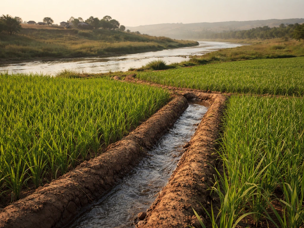
A river is not just a water source and a soil factory. It is a road that does not need to be built, maintained, or paved, and it often connects inland agricultural regions to coastal ports and markets with minimal effort. Moving heavy goods like grain, timber, and pottery by boat is dramatically cheaper and faster than overland transport, especially before railroads. This made river corridors natural trade axes and, by extension, natural places to build cities.
The medieval Nile Delta port of Tinnis is a useful example. Sitting in a sheltered coastal lagoon with preserved canal and harbor infrastructure, it functioned as a major hub for shipping, trading, and fishing, drawing on the agricultural hinterland that the Nile's floodplain had made productive in the first place. In early medieval Netherlands, the Vecht river region shows the same logic: settlements began on natural levees, and the river retained economic importance as a shipping route, evidenced by tollhouses and minting activity along its banks. In England and Wales, medieval floodplain settlement patterns varied with channel style: braided, meandering, and anastomosing rivers offered different crossing points, defensive positions, and resource access, which meant the specific character of the river corridor shaped exactly where towns formed and how they connected to each other. The Mississippi River's entire inland port system, still active today, is built on the same principle of cheap water-based freight movement.
Resources beyond farming: fish, timber, minerals, and grazing
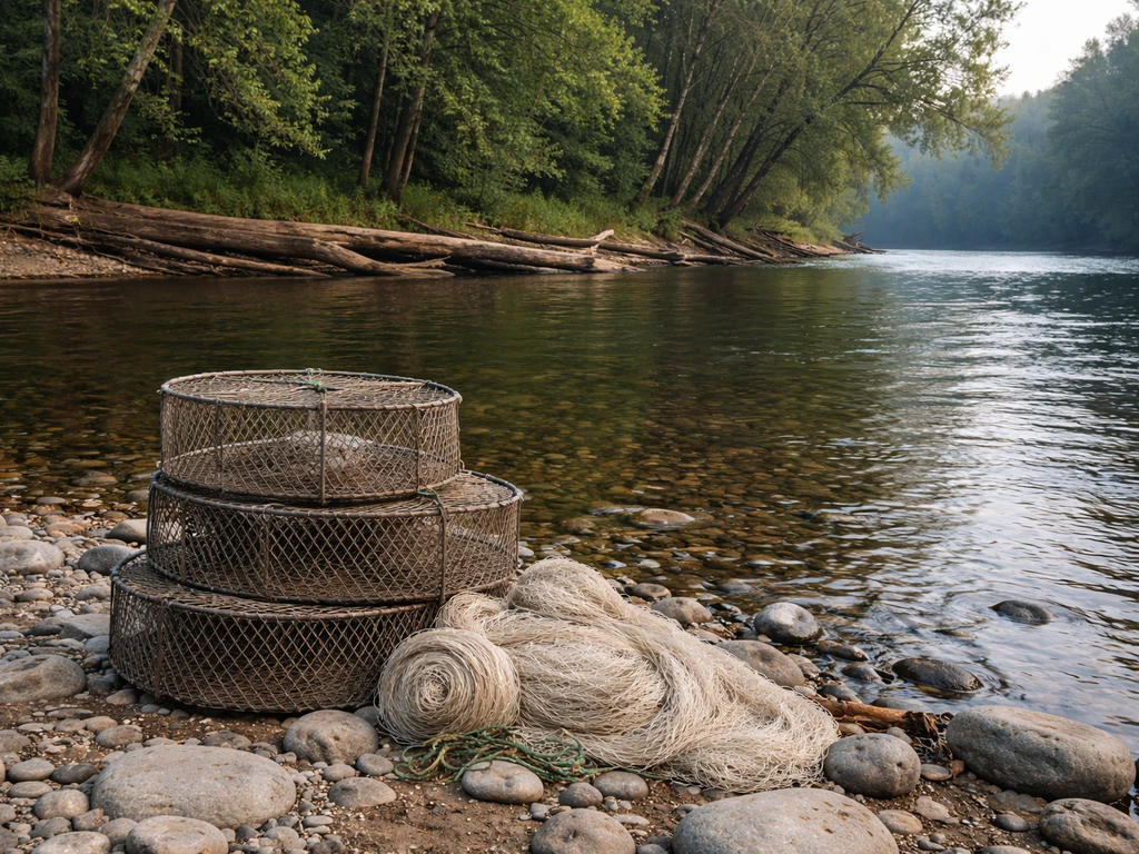
Crops and trade were the headline attractions, but river corridors also bundled in a set of secondary resources that made settlements more resilient and self-sufficient. Fish were a reliable protein source that required no cultivation, and river fisheries in systems like the Tigris-Euphrates and the Nile delta supported large populations. The Tigris-Euphrates marshes, when intact, produced plankton-rich waters that fertilized surrounding soils and supported diverse native fish populations. When those marshes were drained in the twentieth century, the loss of both fisheries and soil fertility was dramatic, illustrating how much the non-farming resource base had always contributed.
Riparian woodlands along riverbanks provided timber for construction and fuel in landscapes that were often otherwise open. River corridors frequently exposed different geological materials through erosion, making mineral and clay deposits more accessible. Floodplain margins and terraces above the active floodplain offered grazing land that was periodically refreshed by flood nutrients. The combination of fish, timber, clay, and pasture alongside cropland meant that a river-valley settlement could meet most of its material needs within a compact geographic zone, which matters enormously for communities without long-range logistics.
How the pattern shifts by region, river type, and time period
The broad logic is consistent, but the specific advantages and risks changed significantly depending on climate, river morphology, and the era of settlement. Understanding those differences is where the agricultural and crop-history angle gets particularly interesting.
| Setting | River character | Key soil/crop advantage | Main risk |
|---|---|---|---|
| Ancient Egypt (arid) | Meandering, predictable annual flood | Deep black silt, reliable nutrient deposition; wheat, flax, vegetables | Flood too high or too low; managed via nilometers and basin systems |
| Mesopotamia (semi-arid) | Braided/variable, erratic Tigris-Euphrates | Alluvial soils good for barley early on; canal-irrigated fields | Salinization, groundwater rise, canal maintenance failures |
| Indus Valley (monsoon) | Seasonal monsoon-fed rivers | Well-drained alluvial soils; wheat, barley, cotton, multi-season crops | Monsoon variability; managed with drainage infrastructure and wells |
| Mediterranean valleys (seasonal) | Seasonal low-flow, episodic floods | Alluvial deposits during flood events; varied soils; olives, grains, legumes | Water stress in dry season; gley/saline soils in wet depressions |
| Medieval lowland Europe (humid) | Meandering, braided, or anastomosing | Riparian floodplain soils; grain, hay, timber; grazing on terraces | Flooding of low-lying fields; channel migration altering land access |
| Modern Mississippi (humid continental) | Large meandering/engineered river | Rich alluvial bottomland soils; corn, soybeans, cotton, rice | Catastrophic flooding; drought-driven navigation disruption |
In drier climates, river valleys were often the only places where farming was viable at all, so settlement concentrated there intensely. In wetter climates, farming could happen on uplands too, so river valleys competed more on the trade and transport advantage rather than being the sole source of water and soil fertility. Braided rivers (common in glacial or high-energy environments) created wide, shifting gravel beds that were less predictable for farming but offered excellent crossing points and gravel resources. Meandering rivers in lower-gradient settings produced the classic oxbow-and-levee floodplain landscape that is most associated with productive agriculture. River terrace formation itself is shaped by long-term climate forcing: as climate shifted and rivers downcut, older floodplain surfaces were stranded as terraces, and those terraces often became preferred settlement sites because they offered fertile former-floodplain soils without the flood risk of the active floodplain below.
Time period matters too. Ancient river civilizations relied almost entirely on natural flood cycles and hand-dug canals. Medieval agrarian societies added mill technology, managed fisheries, and more systematic dyke and levee construction. Modern settlements along rivers are backed by flood-control engineering, but they also carry legacy crop patterns that often trace directly back to the original alluvial soil quality of the valley floor. In the Northern Levant, between roughly AD 150 and 700, valley floors accumulated up to 5 meters of alluvial sediment during a phase of intense soil erosion upstream, rapidly creating new fertile valley floor conditions that would have reshaped what farming was possible there.
Reading the landscape today: what to look for on maps and in the field
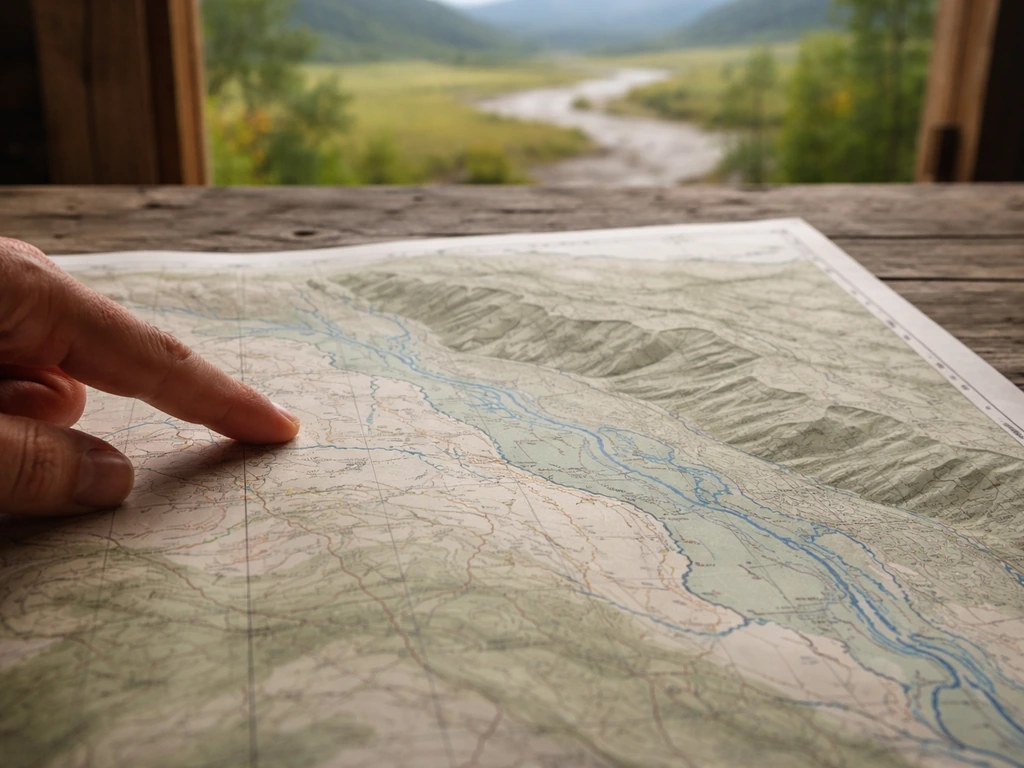
If you are trying to understand why a particular settlement exists where it does, or what crops historically grew in a valley, there are concrete landscape features and map clues that tell the story directly.
- Look for floodplain boundaries on topographic maps. The active floodplain sits at river level, while river terraces are the flat surfaces sitting a few meters higher, separated from the floodplain by a distinct riser or bluff. Terraces are old floodplains, meaning they carry alluvial soils but sit above regular flood reach, which made them preferred settlement sites in most eras.
- Identify oxbow lakes and meander scars. These curved water bodies and vegetation-differentiated arcs on satellite imagery mark where the river used to flow. Older channels tend to be filled with fine sediment, creating locally richer soil patches. They also signal where aquatic resources (fish, waterfowl) would have been concentrated.
- Check soil survey maps for alluvial or fluvial soil series. Any soil described as alluvial, bottomland, or with layered texture profiles (alternating sand and silt layers) reflects flood-deposited origin. Those soils tend to be deeper, better-drained than you might expect, and nutrient-rich, which directly explains crop suitability.
- Look for natural levee microtopography. In historical settlement records and on detailed elevation models, natural levees appear as slightly elevated ridges immediately flanking the channel. Early medieval settlements in the Netherlands' Vecht region began exclusively on these natural levees, and the same pattern appears in delta environments worldwide.
- Trace historical crop records against valley geography. If a region historically grew rice, cotton, or sugar in its lowlands while uplands stayed in grazing or timber, that contrast usually maps directly onto floodplain soil quality versus better-drained upland soils.
- Look for water-management infrastructure as a settlement indicator. Nilometer remnants, canal networks visible in satellite imagery (especially clear in the Mesopotamian region), old levee alignments, and well concentrations all mark where communities invested in managing river water, which in turn shows where the agricultural core of a settlement was located.
- Use historical flood maps and FEMA floodplain designations as a proxy for where ancient floodplain conditions existed. Modern 100-year and 500-year floodplain maps roughly correspond to the extent of historically flood-influenced soils, even if engineering has since altered actual flood behavior.
For anyone working through crop history or agricultural geography, connecting these landscape clues to the crop record is usually straightforward once you know what to look for. The soils that built ancient wheat fields in the Indus Valley and the bottomland cotton fields of the American South follow the same basic formation logic: river, flood, sediment, fertility. The specific crops changed with climate and culture, but the underlying mechanism is the same one that drew people to river valleys in the first place and kept them there.
The river-valley settlement pattern is really a crop-geography story as much as it is a history story. Understanding how the Nile's annual floods shaped Egyptian agriculture, how Mesopotamian irrigation canals extended the Euphrates's reach while also creating salinity problems, or how medieval English floodplain character influenced which settlements became market towns: all of these connect directly to why particular crops grew where they did and why those patterns persist in modern agricultural landscapes today.
FAQ
If rivers provided water, why didn’t settlements grow everywhere along rivers? (What conditions must be present?)
Often, it is an accessibility story plus a productivity story. Even if a community has water, settlements stay sparse if the river does not regularly replenish fertile soils (low sediment loads or highly rocky banks) or if transport is blocked (for example, frequent rapids or long stretches with poor navigability). In contrast, deep, regularly flooded floodplains can support dense agriculture and cheap grain movement even without major roads.
What makes some river valleys much more settlement-friendly than others?
Look for signs that the river was predictable enough to farm but still fertile. Stable flood regimes, seasonal timing that matches crop cycles, and nearby floodplain soils that accumulate fine sediment are key indicators. When floods are too erratic, you see more settlement on higher terraces or levee-like margins rather than on the active floodplain.
How can a river valley settlement shrink even though the river is still there?
Yes. River valleys can become poor places to live when water management is mis-timed or drainage fails. A common historical failure mode is irrigation raising the water table, followed by salt buildup in the root zone, which gradually reduces yields. Even without salinity, repeated crop loss from mistimed floods can push communities to relocate to terraces or shift to less flood-sensitive crops.
Did people always farm and build directly in the floodplain, or did they prefer safer locations?
Many settlements began on natural levees and terrace edges rather than in the middle of the flood basin. These slightly higher zones reduce burial by frequent floods while still staying close enough to reach fertile soils and water. Over time, growing populations sometimes expand onto lower ground once engineering improves or when leaders can mobilize labor to manage defenses.
Why do some river-valley settlements become trading centers while others stay mainly agricultural?
Coastal ports and inland cities both depend on the river, but they capitalize it differently. Ports benefit from year-round or seasonally reliable navigability and sheltered harbors, while inland towns often emerge where shipping intersects fertile hinterlands or where river crossings enable land trade. So the “settlement driver” can shift from farming surplus to freight handling and toll collection depending on where you are along the corridor.
Could fisheries and other river resources be a primary reason for settlement density, not just farming?
Rivers can feed cities, but the amount of fish and the reliability of fisheries depend on habitat. If marshlands are drained, channels straightened, or flood cycles reduced, fisheries often decline and with them a layer of everyday protein and income. This means some communities may have relied on non-farming resources as much as on crops, so settlement resilience can be affected by ecological change.
How does river type, like braided versus meandering, change where towns and farms form?
Channel behavior matters. Braided systems tend to produce shifting crossing points and abundant gravel resources, which can favor specialized sites like fords or extraction areas rather than stable, intensively irrigated fields. Meandering rivers can form the classic levee-and-oxbow mosaic that supports productive farming near levees. In other words, the river’s physical style affects both where land is usable and how transportation works.
What role did early institutions and record-keeping play in making settlements last near rivers?
Where you find nilometer-style measurement or flood-tied taxation, you usually find institutional routines for predicting yields and redistributing risk. That reduces uncertainty for farmers and makes surplus planning possible, which helps cities grow. By contrast, when there is no forecasting or enforcement, households may keep more land for subsistence, limiting the surplus that supports urban life.
How much of the settlement growth was due to human engineering rather than the river’s natural fertility?
Sometimes the “main” driver is not the river itself but how humans build around it. Large-scale ditch systems, controlled basins, or drainage works can turn a marginal valley into a reliable production zone, while the absence of drainage can turn a fertile area into a salinized decline zone. So the long-term settlement pattern often reflects engineering choices as much as natural advantages.
If I’m analyzing one historical town site, what landscape clues should I check first?
If you want to explain a specific settlement’s origin, start with map-based clues: proximity to natural levees or terraces, evidence of ancient canal alignments, patterns of abandoned channels, and soil signatures consistent with repeated alluvial deposition. Then connect that to what crops were viable in that micro-environment, because crop distributions often mirror where flood sediments and water access were most dependable.
Next Articles
How Did the Nile Floods Help Farmers Grow Crops?
Explains how Nile floods timed irrigation, deposited fertile silt, and supplied water so farmers grew more reliable crop
What Environmental Factors Helped Civilizations Grow
Explore how water, fertile soils, stable climate, landforms, and native ecosystems enabled reliable farming and growth.
What Did the Iroquois Grow: Crops and Planting Logic
Learn what Iroquois and Haudenosaunee people grew, from Three Sisters to staples, with planting logic and seasonal rhyth