Growing crops in Mexico is genuinely hard across much of the country, and it comes down to a few brutal realities: most of northern Mexico receives only 200 to 400 mm of rain per year, that rain arrives almost entirely between June and September, and the evaporative demand in those same arid zones is so high that even that modest rainfall largely evaporates before crops can use it. Add thin soils sitting on bedrock, overexploited aquifers, and a rugged terrain that creates extreme microclimates, and you have a country where productive agriculture is possible but rarely easy. The southern highlands and coastal plains are far more forgiving, but even they bring their own constraints.
Why Is It Hard to Grow Crops in Mexico: Causes & Adaptations

Samuel Rourke
24 Jul 2026
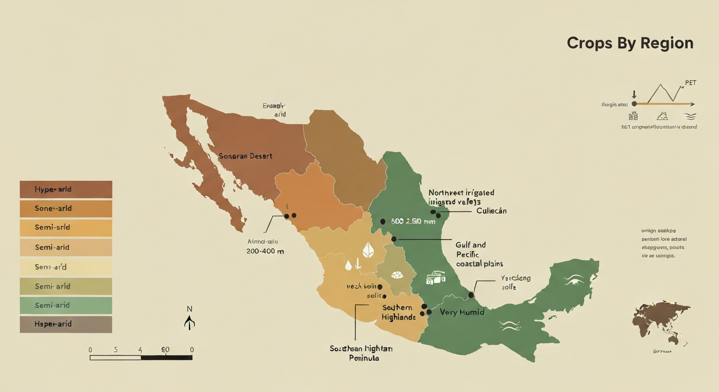
Mexico's agricultural geography at a glance
Mexico spans roughly 1.96 million square kilometers and covers an extraordinary range of environments, from the hyperarid Sonoran and Chihuahuan deserts in the north to the humid tropical lowlands of Chiapas and Tabasco in the south. This diversity sounds like an agricultural asset, and in some ways it is: Mexico produces a remarkable variety of crops across its regions. But the same geographic variety means that any single farming approach fails badly in most parts of the country. Understanding which zone you are working in matters more in Mexico than almost anywhere else.
The country's main agricultural zones break down into five broad types. The northern deserts and semi-arid plateaus are only viable with irrigation. The irrigated river valleys of the northwest (Yaqui, Mayo, Mexicali) are among the most productive in North America but are entirely dependent on dams and groundwater. The central altiplano is semi-arid at lower elevations and cool-to-cold at higher ones. The Pacific and Gulf coastal plains receive more rainfall and support diverse cropping but face their own humidity-driven pest and disease pressures. The southern highlands and Yucatan Peninsula are the wettest zones and historically supported Mesoamerica's most intensive farming systems.
| Region | Annual Rainfall (approx.) | Main Aridity Class | Key Crops | Main Constraints |
|---|---|---|---|---|
| Northern deserts (Sonora, Chihuahua, Baja) | 200–400 mm | Arid to semi-arid | Wheat, cotton, vegetables (irrigated) | Water scarcity, aquifer depletion, high heat |
| Northwest irrigated valleys (Yaqui, Mexicali) | 150–300 mm | Arid (irrigated) | Wheat, sorghum, tomato, asparagus | Groundwater overexploitation, soil salinity |
| Central altiplano (Zacatecas, San Luis Potosí) | 350–600 mm | Semi-arid | Maize, beans, agave, chili | Shallow soils, frost risk, variable rainfall |
| Gulf and Pacific coastal plains | 800–1,500 mm | Sub-humid to humid | Sugarcane, maize, citrus, mango | Pests, flooding, hurricane risk |
| Southern highlands and Yucatan | 1,000–2,500 mm | Humid to very humid | Maize, cacao, coffee, vanilla | Thin soils, steep slopes, deforestation |
Climate constraints: not just dry, but unpredictably dry
The core climate problem in northern Mexico is not simply low rainfall. It is the combination of low, highly seasonal rainfall with extremely high potential evapotranspiration. Using the FAO and UNEP framework, any land where the aridity index (annual precipitation divided by potential evapotranspiration) falls below 0.65 is classified as dryland. Large portions of northern and central Mexico fall well below that threshold. The Penman-Monteith-based global PET datasets from CGIAR-CSI make this visible: evaporative demand in the Sonoran and Chihuahuan deserts routinely exceeds 1,800 to 2,200 mm per year while actual rainfall might be 250 mm. That gap is the fundamental constraint.
The rainy season itself is concentrated almost entirely from June through September, meaning farmers face a long dry winter and spring with little or no soil moisture recharge. This seasonality creates a narrow planting window and makes any crop that needs more than four months of consistent moisture very difficult to establish without irrigation. CONAGUA's climatological station network and the CHIRPS satellite-merged precipitation dataset both confirm high year-to-year variability on top of this seasonal pattern: an individual year in northern Mexico might bring 60 percent of the long-term average rainfall or 140 percent, and farmers cannot predict which it will be. That variability alone makes reliable rainfed cropping a gamble.
The broader southwest North American megadrought, documented in peer-reviewed literature and intensifying sharply through 2020 and 2021, has compounded these baseline conditions. Multi-year droughts reduce soil moisture reserves, lower reservoir levels, and force heavier pumping from aquifers that are already stressed. For a farmer in Chihuahua or Sonora, the practical result is that the buffer that made marginal rainfed land workable in wetter decades has essentially been removed.
Soils and geology: thin, salty, and prone to washing away
Climate gets most of the attention, but soil quality is equally limiting across wide swaths of Mexico. On the volcanic and mountainous terrain that covers roughly two-thirds of the country, soils are often shallow, meaning the rooting depth for crops can be as little as 20 to 40 cm before you hit consolidated volcanic rock, limestone, or compacted hardpan. Shallow soils hold very little water, warm and cool rapidly with air temperature, and erode quickly when rain arrives on bare or cultivated slopes. Erosion is a chronic problem across the central highlands and Pacific mountain ranges, where deforestation and overgrazing have stripped the vegetative cover that once held fragile topsoil in place.
Soil salinity is a serious secondary constraint, particularly in the irrigated districts of the northwest and in coastal zones where saltwater intrusion has advanced into aquifers. When farmers apply water with elevated dissolved salts to already sodium-prone soils, sodium accumulates in the topsoil, disrupting soil structure and making water infiltration progressively worse. CONAGUA's reporting on aquifer overexploitation explicitly flags coastal aquifers where saltwater intrusion is occurring, and this is not an abstract warning: fields in the Mexicali and Sonora coastal strips have been progressively abandoned as salinity thresholds exceed what most commercial crops can tolerate.
Why bedrock and thin soils slow crops down
When crops are planted in soils with very little depth above bedrock or a hardpan layer, several things go wrong at once. See why do crops grow so slow in bedrock for a focused explanation. Roots cannot penetrate far enough to access moisture stored deeper in the profile, so the plant becomes entirely dependent on recent rainfall or irrigation at the surface. Water that would otherwise infiltrate and be held in the soil column instead runs off, taking topsoil with it. The thin layer that does hold moisture dries out quickly between rain events, stressing plants during critical growth stages. Nutrient availability is also compressed: most of the biological activity and organic matter that feeds crops sits in that thin upper layer, and it is the first thing to go when erosion accelerates.
The practical consequence for farmers working bedrock-influenced soils is shorter effective growing seasons, higher sensitivity to dry spells within the rainy season, and lower yield ceilings regardless of how much rainfall the year brings. Crops like maize, which roots deeply given the opportunity, simply cannot perform as designed when root development is blocked at 30 cm. Shallow-rooted alternatives like squash, some beans, and certain tubers are better suited, which is part of why traditional Mesoamerican agriculture developed the milpa system (maize, beans, and squash grown together) as a practical response to these exact conditions.
Topography and elevation: microclimates that help and hinder
Mexico's Sierra Madre Occidental and Sierra Madre Oriental ranges, along with the Trans-Mexican Volcanic Belt, create elevation gradients that generate sharp microclimates within very short horizontal distances. A farm at 1,800 meters elevation in Oaxaca or Puebla may receive adequate rainfall and mild temperatures ideal for maize or coffee, while a farm 40 kilometers away at 500 meters elevation bakes in semi-arid heat. This is both a challenge and an opportunity: elevation diversifies what is possible, but it also means regional generalizations about Mexican agriculture are easily wrong.
High-elevation zones above 2,500 meters face frost risk as a primary constraint. Frost events can occur as early as October and as late as April across the central altiplano, which compresses the frost-free growing window to as little as five or six months. Farmers on these high plains have historically selected cold-tolerant landraces of maize, beans, and potatoes, but commercial varieties optimized for yield often struggle with frost exposure. Valley floors below mountain ranges can experience cold air drainage (temperature inversions) that makes them frost-prone even where the surrounding slopes are protected. Siting crops correctly within a given valley matters enormously.
On the positive side, slopes facing northeast or east in the sierra zones often capture orographic rainfall from the Gulf of Mexico moisture stream, creating surprisingly humid pockets even within otherwise dry mountain ranges. These sheltered, moisture-rich niches are where indigenous farmers historically planted tree crops, cacao, and specialty varieties that needed higher humidity. Mapping these microclimates using WorldClim layers or INECC's national climate data is genuinely useful for anyone planning a new planting in mountainous central or southern Mexico.
Water availability and irrigation infrastructure
Mexico has approximately 6 to 6.5 million hectares of irrigation-capable land, according to FAO AQUASTAT data, and most of that is concentrated in the north and northwest: the Yaqui and Mayo valleys in Sonora, the Valle de Mexicali in Baja California, the Rio Bravo and Lower Rio Grande basins, and the Comarca Lagunera. These districts transformed what would otherwise be nearly uncropable desert into nationally important production zones for wheat, cotton, vegetables, and feed grains. Without that infrastructure, northern Mexico's contribution to national food production would be a fraction of what it is today.
The problem is that the water feeding those systems is increasingly running out. CONAGUA's SIGAGIS database lists over 100 aquifers across Mexico classified as overexploited as of 2023 reporting, with the heaviest concentration in the central-north and northwest basins that support the major irrigated districts. GRACE satellite gravity measurements and InSAR surface deformation studies have independently confirmed significant groundwater storage losses in central and northern Mexican basins. Groundwater depletion in Central Mexico: Use of GRACE and InSAR to support water resources management, Water Resources Research (Castellazzi et al., 2016) provides GRACE and InSAR analyses confirming large groundwater storage declines in central Mexican basins Groundwater depletion in Central Mexico: Use of GRACE and InSAR to support water resources management — Water Resources Research (Castellazzi et al., 2016). Land subsidence in some irrigated valley floors is a visible symptom: when the water comes out and does not recharge, the ground itself sinks. This is not a future risk, it is happening now.
Surface water availability has its own vulnerabilities. Reservoir levels in the major dam systems that feed irrigation canals fluctuate dramatically with the megadrought conditions described above. JRC Global Surface Water Explorer data, based on 35-plus years of Landsat imagery, documents shrinking surface water extent in several key northern reservoirs. When reservoirs drop, irrigation districts receive reduced water allocations, and farmers must either pump more groundwater (accelerating depletion) or reduce planted area. Many do both, which is not sustainable.
Pests, diseases, and land-use pressures
In the wetter regions of Mexico, the challenge shifts from drought to biological pressure. The humid Gulf coastal plain and the southern highlands create ideal conditions for fungal diseases in maize (rust, smut, downy mildew), citrus greening (Huanglongbing), and a wide range of insect pests that thrive in year-round warmth. Fall armyworm has become a major maize pest nationally over the past decade, and whitefly-vectored viruses in vegetable crops are a persistent issue in the northwest irrigated districts as well as tropical lowlands. Managing these requires either chemical inputs that raise costs and raise environmental concerns, or labor-intensive integrated pest management approaches.
Land-use pressure compounds the problem. Deforestation, particularly in the southern highlands and on ejido lands subject to land tenure disputes, exposes slopes to erosion and reduces the natural ecosystem services (watershed function, pest predator habitat, microclimate buffering) that make farming in those areas more resilient. In the north, overgrazing on rangeland adjacent to cropland accelerates wind erosion and degrades the thin topsoil cover that marginal dryland farming depends on. Urban expansion around cities like Hermosillo, Culiacán, and Monterrey is progressively removing the most productive irrigated periurban land from agricultural use.
What history tells us: pre-Columbian solutions still work
It is worth stepping back to acknowledge that people have been farming productively in Mexico for roughly 10,000 years, and they did it without modern irrigation infrastructure or synthetic inputs. They succeeded by developing techniques that directly addressed the physical constraints described above. Terracing on steep slopes (still visible in Oaxaca, Tlaxcala, and parts of Chiapas) controlled erosion and created deeper rooting beds by accumulating soil behind stone or earthen walls. The chinampa system in the Basin of Mexico was an extraordinarily productive raised-bed approach to waterlogged lakeshore environments, combining drainage, composting, and year-round cropping in a system that some researchers estimate yielded multiple harvests per year.
Drought-tolerant crop selection was also a sophisticated pre-Columbian practice. Mesoamerican farmers maintained large numbers of locally adapted maize landraces, selecting for varieties that completed their lifecycle within the available rainy season window even in shorter, more variable rainfall years. Agave cultivation across the central and northern highlands provides a present-day example of a crop that is essentially native to arid and semi-arid conditions and was historically used for food, fiber, and fermented beverages with minimal water input. The lesson from pre-Columbian agriculture is not nostalgia; it is that the physical constraints of Mexican farming environments have been understood and addressed before, and those approaches are worth integrating with modern practice.
How Mexico compares to other challenging crop environments
Readers familiar with farming challenges in other arid regions will find parallels with Mexico's north. The constraints in Chihuahua or Sonora are structurally similar to the challenge of growing crops in the desert: low rainfall, high evaporative demand, shallow or sandy soils, and a dependence on groundwater or distant river systems for irrigation water. The difference is that northern Mexico sits adjacent to some of the most productive irrigated farmland in North America, so the contrast between what is possible with infrastructure and what exists without it is stark and visible within the same region.
Compared to a hyperarid system like the Sahara, northern Mexico is actually moderately well-positioned: it receives more reliable rainfall than most Saharan zones, has existing river systems and mountain recharge areas that feed aquifers, and has a long tradition of both dryland and irrigated farming. See where is it possible to grow crops in the Sahara for maps and practical guidance on suitable cultivation zones. The challenge is not absolute impossibility but the erosion of the margin that made dryland farming viable, driven by climate change, aquifer depletion, and land degradation happening faster than adaptive capacity can respond.
Practical strategies that actually work by region
For anyone farming or gardening in northern Mexico, the most important first decision is water sourcing. Drip irrigation is the only realistic option for most vegetable and tree-crop production in arid zones; it reduces water use by 30 to 50 percent compared to flood irrigation while actually improving crop performance by maintaining consistent soil moisture. Deficit irrigation strategies (applying less than full evapotranspiration replacement but timing applications to protect critical growth stages) can sustain acceptable yields of drought-tolerant crops like sorghum, cotton, and certain vegetables with significantly less water.
Soil management is as important as water management. Adding organic matter through compost or manure improves the water-holding capacity of sandy and loamy desert soils and buffers salinity effects. Mulching reduces soil surface evaporation dramatically, which matters in a zone where ETo might be 6 to 8 mm per day during summer. For saline soils, selecting salt-tolerant crops (barley, sugar beet, certain forages, and halophyte species) or investing in drainage infrastructure to leach salts below the root zone are the two main options.
- Use drip or micro-sprinkler irrigation in arid and semi-arid zones to cut water use by 30 to 50 percent compared to flood irrigation
- Select locally adapted drought-tolerant varieties of maize, bean, and sorghum developed by CIMMYT or local breeding programs for northern Mexico conditions
- Rebuild terraces or construct contour bunds on sloped land to reduce erosion and increase effective rooting depth over time
- Apply mulch or cover crops between seasons to reduce surface evaporation and protect thin topsoil
- Choose salt-tolerant crops (barley, quinoa, cotton, certain forage grasses) in zones with known salinity problems
- Integrate agave, nopal cactus, and other CAM-pathway plants into farming systems on the driest margins where conventional crops fail
- Use agroforestry plantings (mezquite, huizache, fruit trees) as windbreaks and to gradually improve soil organic matter on degraded land
- Check CONAGUA water rights status and aquifer condition before planning any expansion of irrigated area; overexploited aquifers carry legal and physical supply risks
- Consult SIAP municipal crop yield maps to understand what is already working commercially in your specific zone before selecting crops
- In high-elevation zones, time planting to avoid late spring and early fall frost windows identified from local station records
Where crops are and are not viable: a regional summary
| Zone | Rainfed Cropping Viability | Irrigated Cropping Viability | Best-Bet Crops | Key Adaptation Priority |
|---|---|---|---|---|
| Northern deserts (Sonora, N. Chihuahua, Baja) | Very limited; only drought-adapted species on best soils in wet years | High where water is available; dependent on declining aquifers | Wheat, vegetables, alfalfa, cotton | Reduce water use; manage aquifer drawdown |
| Semi-arid central plateau (S. Chihuahua, Zacatecas, Durango) | Moderate in good years; highly variable | Moderate; surface water scarce, groundwater stressed | Maize, beans, agave, chili, orchard crops | Drought-tolerant varieties; terrace and soil conservation |
| Northwest irrigated valleys (Yaqui, Culiacán, Mexicali) | Very limited without irrigation | Very high currently; facing aquifer depletion and salinity | Wheat, tomato, asparagus, sorghum | Drip conversion; salinity monitoring and management |
| Central highlands (Jalisco, Guanajuato, Querétaro, Hidalgo) | Moderate; frost risk at elevation | High; overstressed aquifers in Bajío | Maize, sorghum, strawberry, broccoli, garlic | Aquifer recharge programs; efficient irrigation |
| Gulf coastal plain (Veracruz, Tamaulipas) | Good; adequate rainfall but variable distribution | Good; supplemental irrigation for dry season | Citrus, sugarcane, maize, sorghum, soybean | Hurricane risk management; pest and disease control |
| Southern highlands (Oaxaca, Chiapas, Guerrero) | Good where soils allow; steep slopes limit area | Limited; less infrastructure | Maize, coffee, cacao, beans, tree fruits | Erosion control; agroforestry; landrace preservation |
| Yucatan Peninsula | Moderate; thin karst soils limit water retention despite rainfall | Very limited; little surface water, fragile karst aquifer | Maize, henequen, citrus, vegetable crops | Soil depth management; cenote-based water use care |
What this means for students, historians, and gardeners
If you are a student trying to understand why Mexico's agricultural history looks the way it does, the geography in this article is the foundation. The great pre-Columbian civilizations concentrated where water and soil made intensive farming possible: the Basin of Mexico with its lake system and chinampas, the Oaxacan valleys with their alluvial terraces, the highland maize zones of the central plateau. The north was occupied by groups who practiced extensive rather than intensive agriculture, following seasonal resources and growing drought-adapted crops rather than attempting the kind of surpluses that required heavy infrastructure. That pattern is not a coincidence; it is a direct response to the physical constraints described here.
For gardeners in Mexico or studying its agricultural potential, the takeaway is to start with your zone and its specific constraints rather than assuming any given crop will perform. In some zones, certain crops will not grow without irrigation or substantial soil amendments. A backyard garden in Monterrey faces completely different challenges than one in Oaxaca City or Mérida. Consulting CONAGUA's climate normals for your specific station, checking SIAP's crop performance data for your municipality, and connecting with local agricultural extension services (SAGARPA-affiliated Centros de Apoyo al Desarrollo Rural) will give you far more useful guidance than any general article can provide. Mexico's diversity is its agricultural identity: what grows in one place may genuinely be impossible 200 kilometers away. For a quick guide to regional staples and garden-friendly crops, see what foods grow in Mexico.
FAQ
Why is it hard to grow crops in Mexico, especially in northern Mexico?
Multiple interacting physical and human factors limit crop production. Climatic limits: much of northern Mexico is semi‑arid to arid (mean annual rainfall often 200–500 mm) with strong seasonality (June–September rainy season), high potential evapotranspiration (PET) and large interannual variability and drought risk. Soil and terrain limits: widespread shallow soils, saline/alkaline patches, bedrock near surface, and erosion on steep slopes reduce rooting volume and fertility. Water limits: many irrigation basins rely on over‑exploited aquifers or variable surface supplies, increasing scarcity for irrigation. Biological and land‑use pressures: pests, diseases and competing uses (livestock, mining, urban expansion) add stress. Socioeconomic/policy constraints: water rights, infrastructure gaps, market access and limited extension services constrain adaptive investment. These factors combine to make reliable rainfed cropping difficult across large northern areas and increase dependence on irrigation where water is available.
Which physical datasets and sources should readers consult to verify local constraints?
Key datasets: station normals and time series from CONAGUA for rainfall and temperature; CHIRPS gridded precipitation for recent high‑resolution rainfall and drought mapping; WorldClim climate normals for baseline layers; CGIAR‑CSI Global Aridity and PET datasets to quantify evaporative demand; CONAGUA/SIGAGIS aquifer status and JRC Global Surface Water for surface‑water trends. For soils use national soil surveys and FAO/INEGI maps; for cropping patterns consult SIAP municipal crop and yield maps. These sources enable evidence‑based mapping of aridity, water availability, soils and current crop distributions.
How does Mexico’s aridity and evapotranspiration compare with generic desert challenges (e.g., Sahara)?
Mexico’s dry regions (northern and central basins) are arid to semi‑arid by the FAO aridity index (AI ≤0.65) and face high PET; however, they are generally more climatically varied than hyper‑arid deserts like much of the Sahara. Mexico typically has a defined rainy season, higher elevation gradients producing cooler microclimates, and more seasonal surface‑water sources. Still, crop challenges overlap with desert issues: water scarcity, soil salinity, sparse vegetation, and need for irrigation or drought‑tolerant crops. The presence of irrigation infrastructure and elevation-driven microclimates in Mexico provides more options than many Sahara locations, but long megadroughts and groundwater decline can produce Sahara‑like constraints locally.
Where in Mexico are crops most and least possible? A regional map in words.
Most feasible: coastal plains with reliable rainfall or river supplies (southern Pacific and Gulf coasts), large irrigated valleys and deltas (Valle de Mexicali, Yaqui, Culiacán, Lerma–Chapala downstream systems), highland central plateau and temperate highlands (altiplano) where cooler temps and summer rains support staples, and irrigated irrigable pockets in the north. Less feasible: northern deserts and rain‑shadow basins without reliable irrigation (Sonoran and Chihuahuan deserts), steep mountain slopes with thin soils, and over‑exploited aquifer zones where pumping is unsustainable. Feasibility is highly local—small irrigated oases, terraces or protected culture often enable production in otherwise marginal regions.
Which main crops grow where (native and modern staples, drought‑adapted species)?
Highlands/central plateau: maize (landraces), beans, wheat, barley, potatoes and temperate vegetables. Southern/coastal lowlands: maize, sugarcane, tropical fruits, cacao, coffee (higher elevations), vegetables. Northern irrigated valleys: maize (commercial), wheat, cotton, alfalfa, vegetables, specialty horticulture. Drought‑adapted/desert crops: sorghum, millet, agave (Tequila/mezcal species), nopal (Opuntia), chickpea, certain pulses and forage shrubs. Native staples include maize, beans and squash across regions; agave and cactus species are important in arid zones. Choice depends on water source (rainfed vs irrigated), soil and market.
How do soils and bedrock limit growth and what are “bedrock/slow‑growth” issues?
Shallow soils and bedrock near the surface limit root volume, plant-available water and nutrient holding capacity, resulting in slow crop growth and low resilience to drought. Saline/alkaline soils—common in arid basins and drained irrigated areas—reduce crop choice and yield. Bedrock forces shallow rooting, increases runoff and erosion risk, and constrains soil amendment depth. ‘Slow‑growth’ reflects low organic matter, poor structure, and limited nutrient cycling; rebuilding productive soils requires years of organic inputs, erosion control and sometimes deep ripping or raised beds where feasible.
Next Articles
Crops Will Not Grow: Diagnose Causes and Fix Steps
Checklist and fixes for why crops won’t grow: soil pH, nutrients, drainage or drought, planting errors, pests, and zone-
Why It Is Difficult to Grow Crops in the Desert and What to Do
Desert farming fails from scarce water, harsh heat swings, salty nutrient-poor soils, and erosion, plus fix-first steps.
Why Crops Grow So Slow in Bedrock and How to Fix It
Troubleshoot slow crop growth in Minecraft Bedrock with light, hydration, farmland setup, spacing, and a fast checklist